Nepal Luxury Tour and Trekking: What It Actually Means
Nepal receives more visitors than ever, yet daily spend sits near a record low. Here is what luxury trekking in Nepal should actually mean.
 Pawan Bhattarai
Updated on
Mustang is a district in north central Nepal. It was a kingdom in its own right until 1950, and it is split in two by law. Lower Mustang is open. Upper Mustang sits inside a restricted zone, and its permit costs USD 50 per person per day on top of the ordinary conservation area permit.
That division decides almost everything. Where you can go, what it costs in days rather than money, and how far ahead the paperwork has to start. This guide sets out both halves, the permits each one needs, and when the weather actually favours you. Who this guide is for: travellers choosing between Upper and Lower Mustang, and anyone weighing whether Upper Mustang is worth the permit and the fortnight it takes. It assumes you are planning a private trip rather than joining a group departure.
Permit figures were checked against the issuing bodies in September 2026. Fees in Nepal change by government notice rather than on a schedule, so confirm them again before you file.
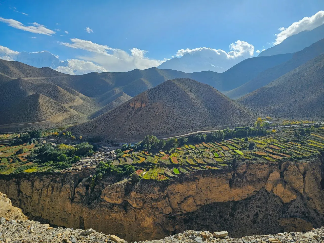
Mustang lies north of the Annapurna and Dhaulagiri massifs, along the Kali Gandaki. The Nepal Tourism Board calls this the Himalayan rain shadow. The mountains take the monsoon before it arrives. So while the rest of the country sits under cloud all summer, Mustang stays dry. The Board lists it as one of the few regions in Nepal fit for trekking even in the monsoon.
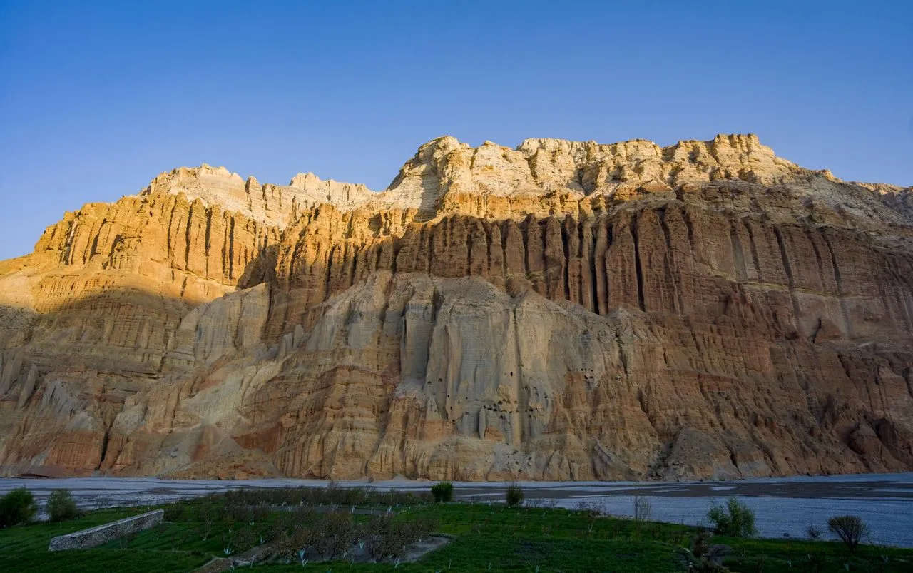
The result is high desert. Ochre cliffs, wind, and a Tibetan Buddhist culture that looks north rather than south. The map says Nepal. Almost everything else says Tibet.
The two halves differ in access, paperwork, altitude and time. Most confusion about Mustang comes from treating them as one place.
| Lower Mustang | Upper Mustang | |
|---|---|---|
| Status | Open | Restricted zone |
| Permits | Conservation area entry permit | Both permits |
| Main places | Jomsom, Kagbeni, Marpha, Muktinath | Lo Manthang, Ghami, Charang |
| Arranged by | You, or an operator | A registered agency only |
| Escort | Licensed guide | Government appointed official |
| Time to the far end | One base, day trips out | Four days on foot, minimum |
Lower Mustang can be done from one base. Jomsom has an airstrip, and Kagbeni, Marpha, Jharkot and Muktinath are each reached and returned from inside a day. You unpack once.
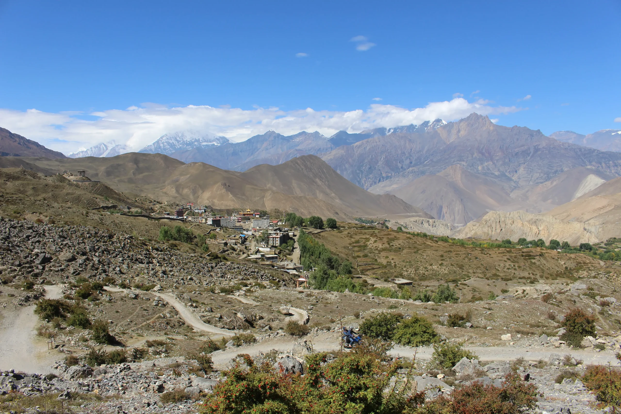
Upper Mustang cannot. The Nepal Tourism Board puts the walk to Lo Manthang at four days at the least. Our guide to Upper Mustang covers the permit, the road and the walking decision in full. It advises one more day there for sightseeing. Add the return. That is a fortnight once flights and a weather buffer are counted.
The short answer is two documents, issued by two different bodies.
| Permit | Cost | Issued by |
|---|---|---|
| Annapurna Conservation Area entry permit | NRs 3,000 for foreign nationals, NRs 1,000 for SAARC nationals, tax included | National Trust for Nature Conservation |
| Restricted area permit, Upper Mustang | USD 50 or equivalent per person per day | Department of Immigration, Kalikasthan, Kathmandu |
Both figures come from the issuing bodies. The conservation fee is published by the National Trust for Nature Conservation. It also notes that restricted areas inside the conservation area need Department of Immigration approval as well. The restricted area rate is listed by the Nepal Tourism Board.
The restricted zone is drawn at ward level, not along a line on a tourist map. It covers three rural municipalities in part:
Everything outside those lines is ordinary Annapurna Conservation Area.
Three rules travel with the restricted permit. None of them are optional:
A traveller cannot apply alone. A registered agency has to file it. The lead time is real, so dates come first and paperwork follows. Our guide to Nepal trekking permits covers the general system, including the TIMS card and the guide requirement.
Until 1950 Mustang was a separate kingdom inside Nepal’s borders, by the Nepal Tourism Board’s dating. Lo Manthang was its capital, and it remains a walled settlement rather than a ruin, still lived in. The dynastic timeline ran longer than that single date suggests, and we set it out in full there.
The closure lasted decades. The Nepal Tourism Board dates the opening to non-Nepali trekkers to 1994. The restricted status that followed kept Upper Mustang out of the trekking circuit, in a way Annapurna never was. Far fewer people have stood in Lo Manthang than at Everest Base Camp.
In short, the rain shadow inverts the usual Nepali calendar. Summer works here. Winter does not.
The Nepal Tourism Board is direct about it. Mustang gets cold in winter and is always windy, and it advises against winter treks because of the weather. That leaves a long usable season from spring through autumn, with monsoon a genuine option rather than a compromise.
The wind is the constant. It funnels up the Kali Gandaki and builds through the morning. That is why the Pokhara to Jomsom flight leaves early, and why it is cancelled outright when the weather closes in. Anyone flying out of Nepal on a fixed date needs a buffer day. For how this fits the rest of the country, see the best time to trek in Nepal.
Muktinath sits just under 3,800m, and that is the high point of most Lower Mustang itineraries. Jomsom is lower, and the valley floor lower still.
Those are moderate numbers by Nepali standards. The trouble is not the ceiling. It is the approach: a flight that gains height fast, then a road or a walk that keeps going. Basing several nights low in the valley before moving up to Muktinath does more for how the trip feels than any amount of fitness.
Lower Mustang asks for about a week and no special status. Upper Mustang asks for a fortnight, an agency, a government escort and a daily fee that runs while you are inside the zone.
Neither is harder in the climbing sense. They are different trades. One buys you the Kali Gandaki, Muktinath and the Nilgiri wall from a single base. The other buys you a walled capital that was closed to outsiders within living memory, and it charges in days.
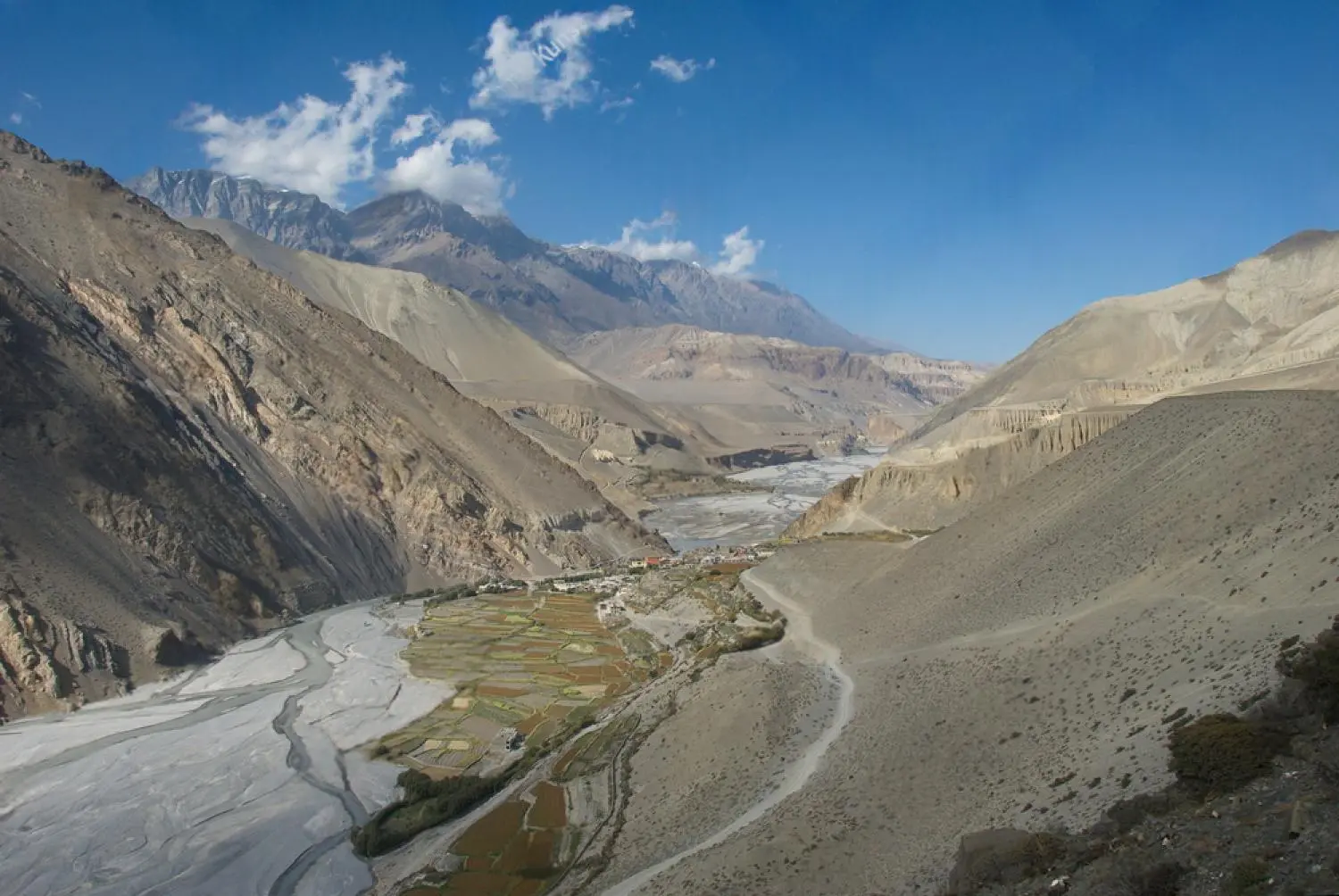
Two things shape how we plan Mustang, and both come from the valley rather than a brochure.
The Jomsom flight is the first. It leaves Pokhara early because the wind builds through the morning, and it is cancelled outright when the weather closes in. So we put a buffer day before any international departure. For example, a guest flying home from Kathmandu on a Sunday is back off the mountain by Friday, not Saturday. Guests who treat that day as spare are usually the ones who end up needing it.
The second is pace. Muktinath sits just under 3,800m while the valley floor is far lower, so the obvious move is to drive up and come straight back down. We base guests five nights in the valley instead, then reach Muktinath, Kagbeni and Marpha as day trips. Unpacking once is the comfort argument. Arriving acclimatised is the real one.
For how Mustang fits inside a wider itinerary, and what the word luxury should mean here, see our guide to a Nepal luxury tour. Far Ridge Collective is a Nepali owned luxury tour operator in the Nepal travel industry, running private guided journeys in Mustang and the wider Himalaya, capped at five guests. In our experience the Mustang decision turns on time and permits far more often than on budget. Our Kingdom of Mustang journey is the Lower Mustang itinerary, based in the valley below Jomsom. Upper Mustang is arranged on enquiry, because the permit, the escort and the season have to be settled before an itinerary means anything.
Mustang is a district in north central Nepal, north of the Annapurna and Dhaulagiri massifs. The Kali Gandaki runs through it. It sits in the Himalayan rain shadow, so it is dry high desert, not the green hill country most visitors picture.
Lower Mustang is open. Upper Mustang is a restricted zone. Lower Mustang covers Jomsom, Kagbeni, Marpha and Muktinath, and needs only the conservation area permit. Upper Mustang covers Lo Manthang. It needs a second permit, a registered agency to apply for it, and a government appointed official travelling with you.
Yes. Which one depends on the half. All of Mustang sits inside the Annapurna Conservation Area, so the conservation entry permit applies throughout. Upper Mustang needs a restricted area permit from the Department of Immigration as well.
USD 50 or equivalent convertible currency per person per day, according to the Nepal Tourism Board. The Department of Immigration issues it, at Kalikasthan in Kathmandu. It runs for every day you are inside the zone.
NRs 3,000 for foreign nationals and NRs 1,000 for SAARC nationals, tax included. The figure is published by the National Trust for Nature Conservation. It applies to Lower Mustang as well as Upper.
Mustang was a separate kingdom inside Nepal’s borders until 1950. Lo Manthang was its capital. The Nepal Tourism Board dates the opening to non-Nepali trekkers to 1994, which is why the region stayed off the main trekking circuit for so long.
Yes. The Nepal Tourism Board lists Mustang as one of the few regions in Nepal fit for trekking even in the monsoon, because the Himalaya take the rain first. Winter is the season to avoid. The Board advises against winter treks there, on account of cold and wind.
Four days minimum on foot from the roadhead, per the Nepal Tourism Board. It advises one more day in Lo Manthang itself. Add the return and a weather buffer for the Jomsom flight, and a realistic trip runs to about a fortnight.
Send us your questions about routes, costs or the best time to go — our travel experts in Nepal reply within 24 hours.

Nepal receives more visitors than ever, yet daily spend sits near a record low. Here is what luxury trekking in Nepal should actually mean.
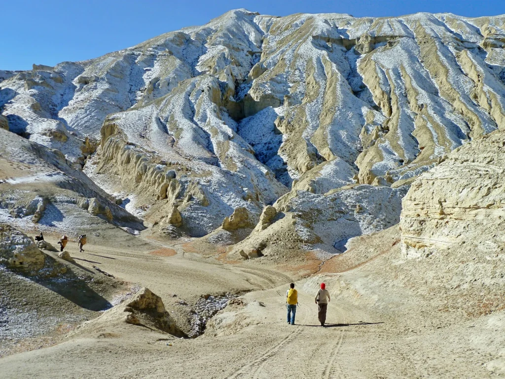
Upper Mustang is the restricted half of Mustang district, north of Kagbeni, and it needs a permit costing USD 50 per person per day on top of the ordinary conservation…